NISAR Launches July 30: A NASA-ISRO Satellite to Track Earth’s Changes

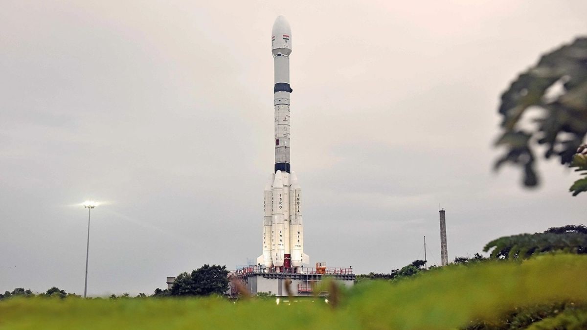
The NASA-ISRO Synthetic Aperture Radar (NISAR) satellite, a joint Earth science mission, is now set for launch from India’s Satish Dhawan Space Centre. The pickup-truck-sized spacecraft was encapsulated in the nose cone of an Indian Geosynchronous Satellite Launch Vehicle and is scheduled to lift off on Wednesday, July 30 at 8:10 a.m. EDT (5:40 p.m. IST). Once in orbit, its dual-frequency radars will circle Earth 14 times a day, scanning nearly all of the planet’s land and ice surfaces every 12 days. It will provide data to help scientists monitor soil moisture and vegetation, and better assess hazards like landslides and floods.
According to the official website, NISAR reflects a significant NASA–ISRO partnership. NASA’s Jet Propulsion Laboratory (JPL) built the long-wavelength L-band radar, and India’s Space Applications Centre built the shorter-wavelength S-band radar. This dual-frequency design makes NISAR the first Earth satellite to carry two radar systems, underscoring the mission’s unique collaboration.
The spacecraft is now integrated into its launch vehicle at India’s Satish Dhawan Space Centre. On July 28 NASA announced NISAR had been encapsulated in the payload fairing of an ISRO Geosynchronous Satellite Launch Vehicle on the pad. The GSLV is scheduled to lift off at 8:10 a.m. EDT (5:40 p.m. IST) on Wednesday, July 30.
NISAR carries a novel dual-frequency radar system. The satellite’s instruments operate at L-band (25 cm) and S-band (10 cm) wavelengths. The longer L-band waves can penetrate forests and soil to sense moisture and land motion, while the shorter S-band waves pick up fine surface details like vegetation moisture and roughness. This combination lets NISAR detect both large-scale and fine-scale changes.
From orbit, NISAR will circle Earth 14 times per day, scanning nearly all land and ice surfaces twice every 12 days. Its data will track changes like the advance or retreat of polar ice sheets and slow ground shifts from earthquakes, and will also aid agriculture and disaster planning by helping monitor crops and prepare for floods and hurricanes.