Weather: Met Office issues snow and ice warnings as parts of UK told to prepare for ‘hazardous conditions’

Yellow weather warnings have been issued, with parts of the UK told to prepare for “hazardous conditions” as snow and ice is forecasted.
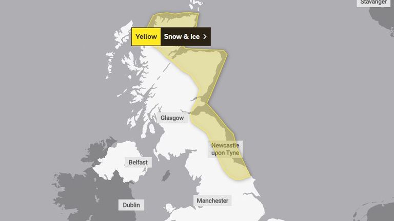
The Met Office has said roads and railways are likely to be affected, with the warnings issued until Thursday morning.
Warnings cover parts of Scotland and northeast England.
Forecasters warned:
Find out the forecast for your area
Central Scotland, Tayside, Fife, Grampian, Highlands, Eilean Siar, Orkney, Shetland, southwest Scotland, Lothian, Borders and Yorkshire and Humber are some of the affected regions on Tuesday.
People are being told to brace for potentially “hazardous conditions” into Wednesday morning if snow falls and icy patches form.
The warnings last until Thursday at 11am.
The Met Office said: “Wintry showers will lead to ice forming on untreated surfaces during Tuesday evening and overnight into Wednesday morning.
“Snow will begin to accumulate, especially away from windward coasts, with 1-3cm possible. Higher routes of northeast Scotland may see up to 5cm of snow accumulate.”
Read more on Sky News:
UK considers way to block export of Elgin Marbles
London to New York flight fuelled by cooking oil
Wilko boss explains chain’s collapse
The Met Office has also issued advice for how people can stay safe in icy conditions – urging people to check on elderly relatives or neighbours who might need support.
Motorists have been told to avoid driving in icy conditions wherever possible. If driving is unavoidable, they are advised to look well ahead for potential hazards and keep their speed to a minimum.
People who are walking or cycling are advised to leave the house five minutes earlier than normal and to try and avoid slippery surfaces.


